Stone Cities, Fading Names: The Citizen Guardians Racing to Preserve America's Historic Burial Grounds

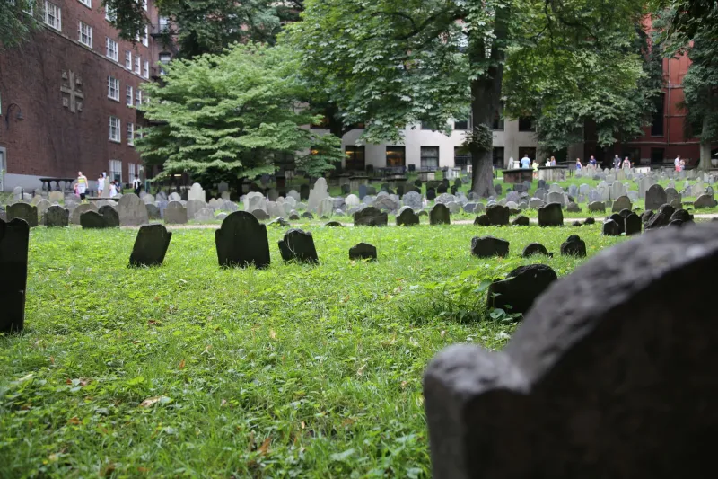
Photo by Photo by Lumin Osity on Unsplash on Unsplash
On a cool Saturday morning in October, a group of eleven volunteers assembles at the iron gate of the Prospect Hill Cemetery in Brattleboro, Vermont, carrying clipboards, digital cameras, soft brushes, and a shared sense of urgency that their cheerful conversation does not entirely conceal. Their task for the day is the documentation of the cemetery's oldest section — a hillside quadrant where the earliest markers, some dating to the 1790s, have been subsiding into the earth at a rate that makes each passing season measurably more damaging than the last.
This is not a municipal project. The city of Brattleboro does not employ these people. They are members of the Windham County Cemetery Preservation Alliance, a volunteer organization founded in 2009 by a retired schoolteacher named Gordon Ellsworth, who noticed that the sandstone markers in his town's oldest burial ground were eroding faster than anyone seemed to realize or care. What began as a one-man documentation effort has become a regional network of more than two hundred volunteers, a digital archive of over forty thousand photographed markers, and a model that preservation advocates in other states have begun to replicate.
"Every one of these stones is a sentence in a paragraph we are losing," Ellsworth says, kneeling beside a marker so weathered that its inscription is visible only in raking light. "When it's gone, that sentence is gone. There is no draft. There is no backup."
The Archive Beneath the Grass
American burial grounds constitute what historians of material culture have described as the nation's most democratic archive. Unlike courthouses, which preserved the records of property owners, or churches, which documented the baptized, cemeteries accepted — with varying degrees of dignity — the bodies of the poor alongside the prosperous, the immigrant beside the native-born, the enslaved in proximity to those who enslaved them. The landscape of a cemetery, read carefully, encodes social hierarchies, immigration waves, epidemic mortality, religious affiliation, and the aesthetic values of successive generations.
The inscriptions themselves are primary documents. Epitaphs record not only names and dates but occupations, causes of death, familial relationships, and occasionally the specific circumstances of a life's end — the sailor lost at sea, the infant who survived three days, the veteran of a war whose name the stone spells out in full. For genealogical researchers, particularly those tracing families whose paper records are incomplete or nonexistent, a legible gravestone can be the only surviving evidence of a life.
Dr. Harriet Combs, a historical archaeologist at the University of Georgia who has studied African American burial grounds throughout the rural South, describes the stakes with precision. "In communities where enslavement disrupted record-keeping for generations, the cemetery is often the first place where individuals become visible as individuals rather than as property," she explains. "The transition from a plantation inventory to a named grave marker is a profound historical moment. When that marker erodes, that moment is erased."
The Threat Inventory
The pressures facing historic burial grounds in the United States are varied and, in many cases, mutually reinforcing. Natural weathering is the most universal: sandstone and marble, the predominant materials of eighteenth and nineteenth-century American grave markers, are susceptible to acid rain, freeze-thaw cycles, and biological growth that gradually obscures and ultimately destroys inscriptions. Granite, more durable, became the standard only in the late nineteenth century, meaning that the oldest and historically richest markers are precisely the most vulnerable.
Vandalism represents a chronic and deeply dispiriting threat, particularly in urban and suburban cemeteries where maintenance resources are limited. The Association for Gravestone Studies, a national organization headquartered in Greenfield, Massachusetts, estimates that tens of thousands of historic markers have been damaged or destroyed by deliberate acts in the past two decades — a figure that the organization's executive director, Carol Grissom, describes as almost certainly an undercount.
Perhaps less visible but equally consequential is the threat of institutional abandonment. Hundreds of rural church cemeteries across the United States are associated with congregations that have dissolved, merged, or relocated, leaving burial grounds without any organizational custodian. Municipal governments, facing budget constraints, frequently lack the resources to maintain historic sections of public cemeteries that generate no revenue. The result, in many communities, is a gradual reversion to nature — grass consuming pathways, trees heaving stones from their foundations, the entire landscape becoming illegible.
Digital Resurrection
The volunteer documentation movement has found its most powerful tool in digital photography combined with online databases. Find A Grave and BillionGraves, the two largest crowdsourced cemetery documentation platforms, together contain records of more than two hundred million grave sites worldwide, the vast majority contributed by unpaid volunteers who photograph, transcribe, and upload marker information in their own time and at their own expense.
The scale of this collective project is remarkable. In rural counties where no professional survey has ever been conducted, volunteer contributors have documented burial grounds that official records did not acknowledge existed. In urban areas, where development pressure has threatened or destroyed historic cemeteries, digital records have occasionally provided the only surviving evidence of a site's contents — evidence that has, in several documented cases, influenced legal proceedings over cemetery relocation.
But the limitations of crowdsourced documentation are significant. Transcription errors propagate through databases. Photographs taken without standardized lighting or framing are difficult to analyze systematically. And the most deteriorated markers — precisely those most urgently in need of documentation — are often beyond the capacity of standard photography to capture meaningfully.
This is where more specialized techniques enter the preservation toolkit. Photogrammetry, which constructs three-dimensional digital models from multiple overlapping photographs, allows researchers to capture the surface topography of a stone with sufficient resolution to render inscriptions that are invisible to the naked eye. Reflectance Transformation Imaging, a technique borrowed from archaeological field practice, uses controlled raking light from multiple angles to reveal surface details on even severely weathered stone.
The Friends of Laurel Hill Cemetery in Philadelphia have employed both techniques in their ongoing documentation of the cemetery's oldest sections, producing a digital archive that its director, Sara Stevenson, describes as "a form of resurrection — not of the dead, but of their names."
The Landscape as Argument
Beyond individual markers, preservation advocates are increasingly attentive to cemetery landscapes as coherent historical documents in their own right. The spatial organization of a burial ground — which families occupy which sections, where the boundaries of segregated areas run, how the topography relates to the social geography of the community it served — communicates historical information that no individual stone conveys.
At Mount Auburn Cemetery in Cambridge, Massachusetts — the nation's first rural cemetery, established in 1831 and a National Historic Landmark — landscape historian Keith Morgan has spent three decades documenting the relationship between the cemetery's evolving design and the shifting cultural attitudes toward death, nature, and civic memory that it reflects. "Mount Auburn is not just a cemetery," Morgan observes. "It is a record of how Americans thought about mortality across two centuries. The landscape itself is the primary source."
This understanding — that the cemetery as a whole constitutes a historical argument, not merely a collection of individual markers — is reshaping preservation strategy. Advocates increasingly seek National Register designation not just for individual stones but for entire cemetery landscapes, a designation that provides some protection against development and unlocks eligibility for federal preservation funding.
The Work That Remains
Back on the hillside in Brattleboro, Gordon Ellsworth kneels beside a marker so eroded that only the ghost of letters remains visible. He photographs it from six angles, notes the GPS coordinates on his clipboard, and moves to the next stone. There are forty-seven more in this section alone, and the light is already beginning to shift.
He will return next month, and the month after. The archive he is building will outlast the stones it documents. That, he understands, is precisely the point — to ensure that when the last inscription finally surrenders to weather and time, the name it carried will not disappear with it, but will persist in a form that the next generation of curious, devoted citizens can find and read and pass forward.
The dead, in this sense, depend upon the living. And in communities across America, the living are answering.